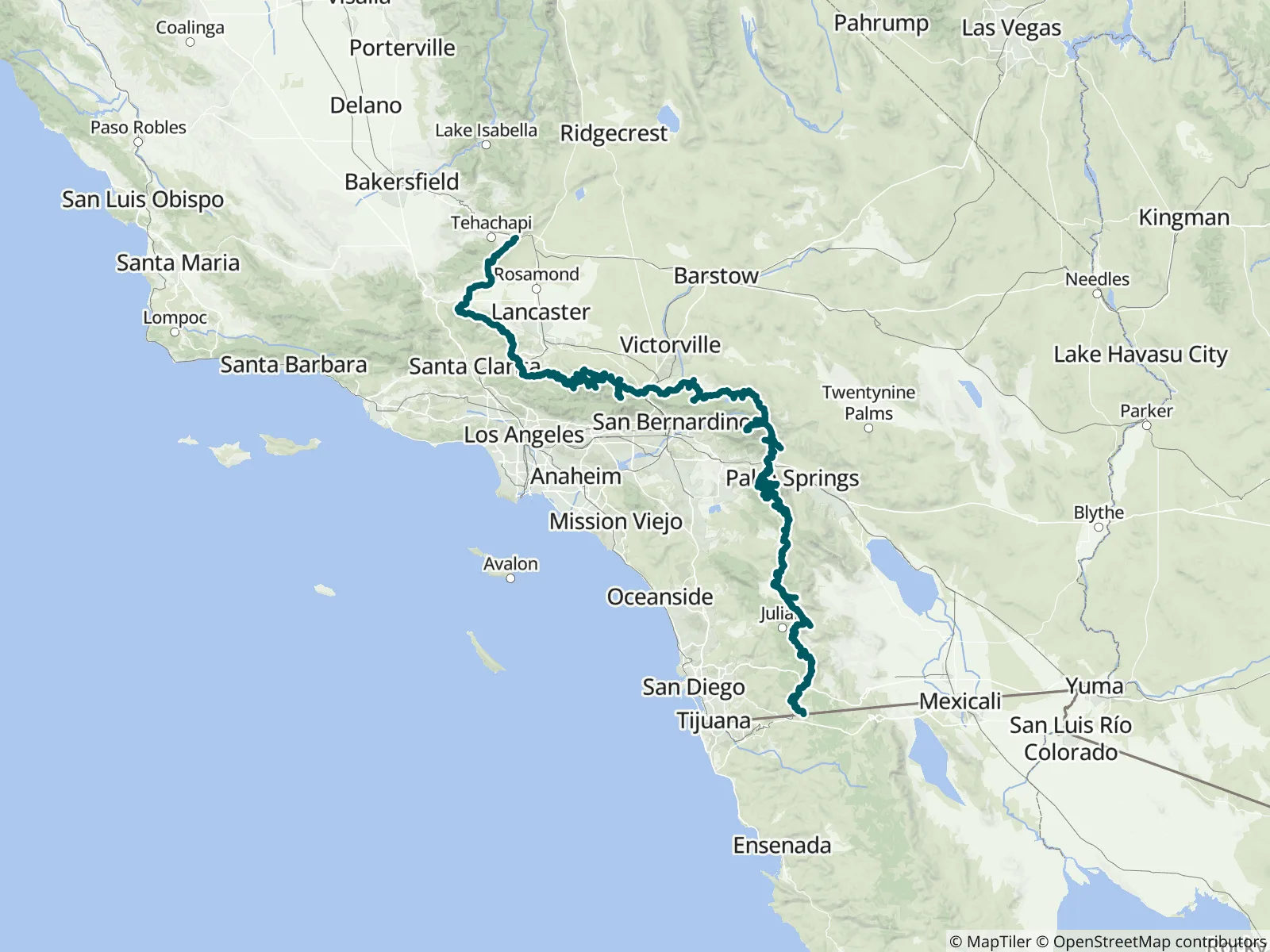
This FarOut guide covers the 566.5-mile Southern California portion of the Pacific Crest Trail, Sections A to E from the Mexican border near Campo to the Tehachapi–Mojave desert, part 1 of FarOut's five-part PCT guide. It holds more than 1,100 waypoints, water sources included, and over 150 access and side trails, among them San Jacinto Peak and Mount Baden-Powell. FarOut has published the PCT since 2012 and works informally with the agencies along it to keep the guide current.
“No need to worry about this water! Caretaker Todd lives here year round and checks everyday. Was super friendly, gave me a Sprite! SOBOs, you can road walk from here all the way to the Mt. Gleason Road junction at 2234.6. Distance is abou…”
“Yes, there is water. Yes, this water is kinda gross. Might need to get a lttle creative and use some trekking pole tech to get it. Would probably be fine through a filter if you moved the film but im double treating it just in case. If tim…”
“Good water! Thanks for taking care of us! :)”
“Shallow pools”
“Stream has a slight trickle”
“Flowing well”
“Open red valve on bottom of big tank. Open blue valve on side of horse tank. Turn on water. Fill bottles. Turn off water. Close blue valve on side of horse tank. Close red valve on bottom of big tank. Thirst responsibly quenched.”
“There are full troughs that are being fed from a piped spring. Plenty of water from the recent rains. Follow the other comments to get to it. Was about a 5 minute climb, which might be the best youre gonna get around here.”
“2 gallons here :)”
“No more water :(”