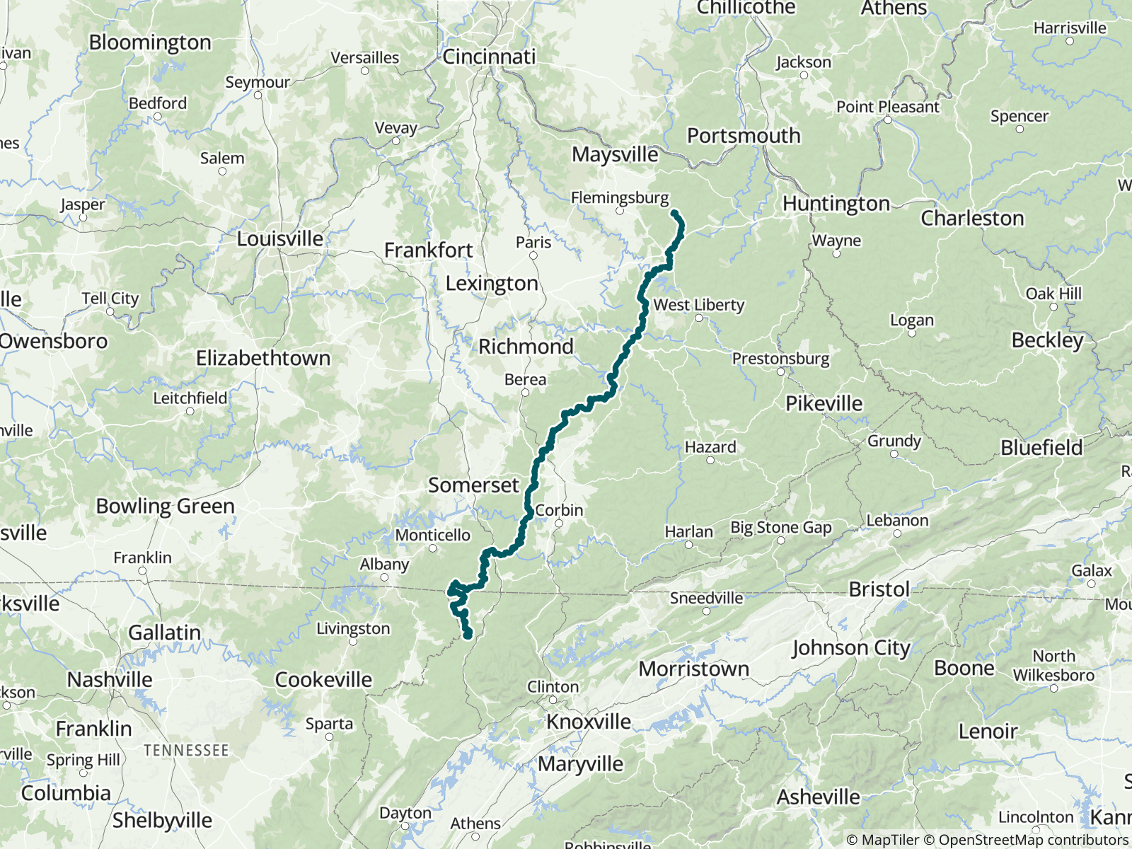
The Sheltowee Trace is a 343-mile (552 km) National Recreation Trail created in 1979, stretching from the Burnt Mill Bridge Trail Head in Tennessee's Big South Fork National River and Recreation Area to northern Rowan County, Kentucky. Named for Daniel Boone, called Sheltowee ("Big Turtle") by the Shawnee, it runs mainly through the Daniel Boone National Forest and passes Cumberland Falls State Resort Park. FarOut publishes this guide in partnership with the Sheltowee Trace Association.

The Sheltowee Trace Association is a 501(c)3 volunteer based organization. The organization has the mission of protecting, preserving, and promoting the Sheltowee Trace National Recreation Trail. The Sheltowee Trace is a significant national resource for the enjoyment of hikers, bikers, and equestrians. The wild and scenic lands provides a lot of value to all people. Sheltowee Trace Association website All partners
“Shallow stream. Scoopable if needed.”
“Bridge crossing, no water. Dry as a bone.”
“The sites are managed by the US Army Corps of Engineers. PICNIC sites 17 & 18 only are available for backpacker camping. Rules: 1) sites are available 1st come first served. 2)Tents or tarps may be set up between hours of 6pm and 10am. Hik…”
“Dry.”
“Stagnant”
“There is absolutely no water here nobo at bottom of hill yes”
“Great campsite. Plenty of water flowing.”
“Dry -KD”
“Alum Ford Campground toilets must reserve ste. Wifi Version”
“Great spot close enough to the road. Fire ring worked out great drying wet shoes. Room for several hammocks and tents”