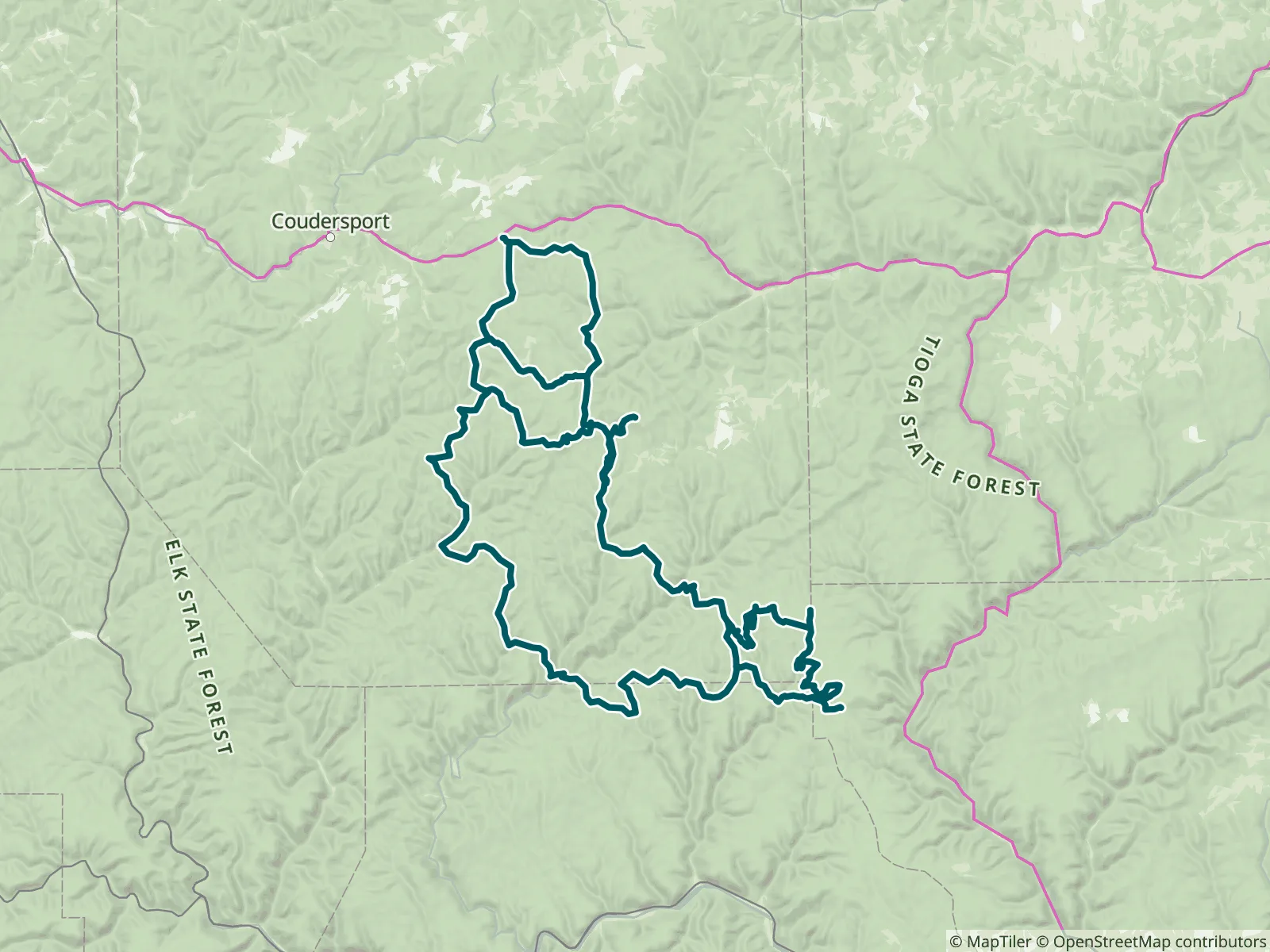
Located in Pennsylvania's Potter and Clinton counties, the Susquehannock Trail System (STS) is an 84-mile loop hiking trail marked with orange paint blazes. Part of it runs with the Donut Hole Trail, a link connects to the Black Forest Trail, and two cross-over trails allow shorter loops. The most secluded section is a 10-mile stretch through the Hammersley Wild Area, Pennsylvania's largest wild area. FarOut publishes this guide in partnership with the Susquehannock Trail Club.

The mission of the Susquehannock Trail Club is to build and maintain trails, aid in the conservation of wetlands and wildlife and promote good fellowship through the medium of hiking and nature study. The Susquehannock Trail System, also known as the STS, was conceived as a hiking trail in 1966. The late William D. Fish, Jr. originated the idea to create the trail. This idea quickly grew and the Susquehannock Trail Club formed in 1967. The volunteers quickly performed the actual work of laying out, marking and completing the physical improvements of the trail. The trail was named after the Susquehannock State Forest, which in turn was named for the Susquehannock Indian Tribe. The Susquehannock Indian Tribe claimed most of the land in this region during the late 1500’s and early 1600’s. The STS is a link-up of old fire trails, abandoned railroad grades, dirt logging roads and pipeline clearings. The old fire trails, constructed by President Franklin Roosevelt’s Civilian Conservation Corps in the 1930’s. The work of the Civilian Conservation Corps makes up 85% of the trail. The 84-mile loop trail was built for foot travel only and is marked with 2” x 6” rectangular orange blazes. The STS passes near Lyman Run and Cherry Springs State Parks, through Ole Bull and Patterson State Parks. The trail also passes through the small village of Cross Fork. Susquehannock Trail Club website All partners
“Clean restroom with toilet paper. Covered picnic tables out of the rain. Water pump is chain locked. Early in the day so I just hiked on.”
“Good flow, clear water.”
“About 3 gal of water in the cache.”
“Water flowing”
“Great flow, just over ankle deep and 20 feet wide. The climb of the trail is maybe 15 feet down to camp site. Plenty of places where people have carved trails down here. Best camping spot so far.”
“Nice shelter with flowing stream 25 feet from front of shelter. Deep enough to soak ankles and feet.”
“Nice shelter, stocked with 6 full gallons of water”
“Shallow stream but flowing. Easy to scoop”
“Good flow. Dunk 3L bladder easy”
“Great Water source, flowing”