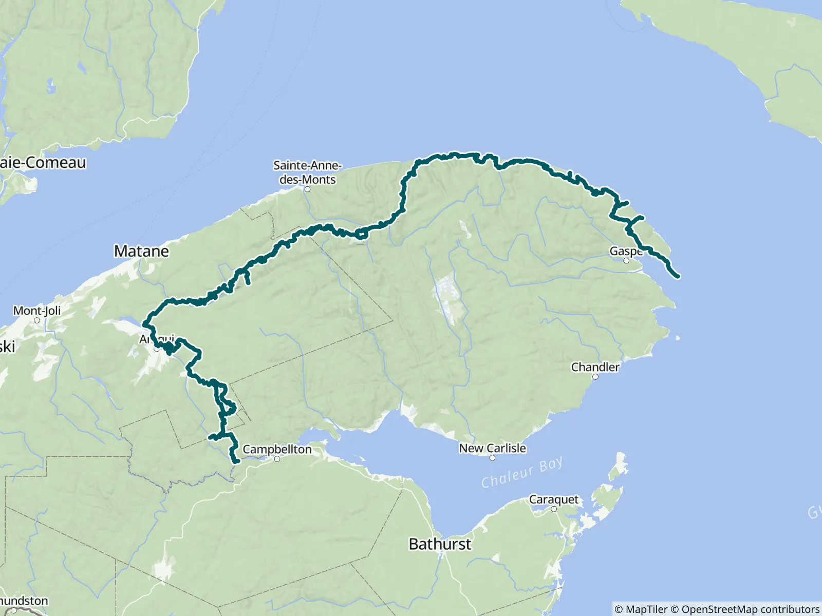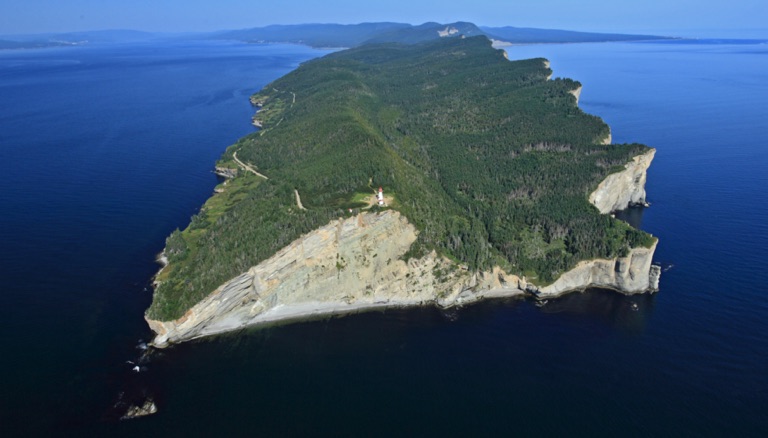
The Québec section of the IAT/SIA is about 401mi/645km long and begins in Matapédia at the bridge over the Restigouche River, running northwest to Amqui. It heads through the Reserve Faunique de Matane to Mount Logan in the Parc de la Gaspésie, then east across Mont Albert and Mont Jacques Cartier to the cliffs of Cap Gaspé in Forillon National Park. FarOut publishes this guide in partnership with The Maine Chapter of the International Appalachian Trail.

The Council of the International Appalachian Trail was launched in June 1994. Representatives from Maine, New Brunswick and Quebec gathered to begin the work. The goal was to complete a footpath to connect the three highest points of land in each jurisdiction. Now, 22 chapters in 13 countries on 3 continents around the arc of the North Atlantic Ocean Basin continue the work. Chapters take on the responsibility of building and maintaining the footpath. The trail traces the ancient Appalachian/Caledonian mountain chain from North America to North Africa. The Council is an informal association whose members agree to a set of structures and responsibilities. These responsibilities includes establishment and maintenance of the footpath, the creation of maps, guides, and other promotional materials. Chapters are encouraged to develop their own means of public communication and education. All of the chapters contribute stories and other promotional material to the shared web portal. The Maine Chapter of the International Appalachian Trail website All partners
“This shelter has amazing potential, but when I arrived, it looked utterly abandoned. I’m not squeamish about mice, but they were running freely in the shelter and it smelled strongly of droppings. Definitely put your bag on the metal sto…”
“Really great shelter. Quiet, super clean, and not far off trail. And there are wild blueberries in every direction. As folks say, walk into town and the dépanneur has free showers, bottled water, and a few snacks. NOBO, after the hike fr…”
“Running well, clear and cold. Worth the stop!”
“Bel abri avec vue. Le toit coule un peu du côté droit (dos à l'abris). Semble largement utilisé par des randonneurs à la journée qui ont laissé des déchêts et en ont même mis dans le baril récupérateur d'eau.”
“I got here after hours but comments about spigots, outlets, toilets, wifi etc all still valid. RVs are permitted to camp here and some generous folks gifted me a beer. It's a fabulous spot to hang out and enjoy the golden hours. Bliss!”
“Creek is flowing. North of this waypoint is a section that is very sloppily done by Far Out. Many junctions aren't marked and the track line is off. Luckily the trail is very obvious as it's quite the tourist route.”
“I camped at Long Lake. There is highway noise but no one came to the lake while I was there. Lots of mosquitoes unfortunately. Water from the lake has a strong algae taste, even after filtered, better to collect elsewhere or bring from tow…”
“There is camping further east on the point next to the lighthouse. Sign said $20 but I didn't verify as I was only stopping by for the bathroom. Beautiful scenery out there, worth the small 0.35 mile detour.”
“Nearby spring is flowing.”
“Ankle deep. Nice and cold.”