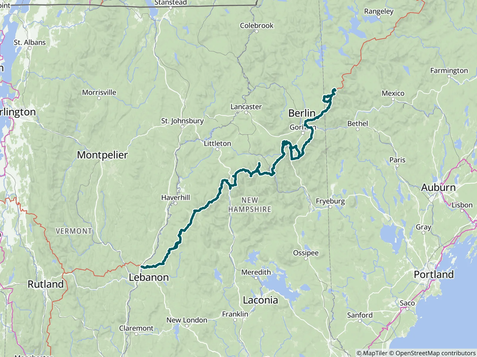
This FarOut guide covers the 175.5-mile section of the Appalachian Trail from Hanover, New Hampshire, to Grafton Notch, Maine, part 8 of FarOut's nine-part A.T. guide. It includes the whole White Mountain National Forest crossing, Smarts Mountain and Mahoosuc Notch. FarOut is the Official Hiking App of the A.T., in partnership with the Appalachian Trail Conservancy.

Since 1925 the Appalachian Trail Conservancy has been leading the management and conservation of the Appalachian Trail and its landscape—a sanctuary from the modern world where nature thrives and people can connect with its transformative power. Each year, the A.T. landscape draws millions of visitors, serves as a critical wildlife corridor and refuge for thousands of diverse species, and plays a vital role in driving climate resilience and economic vitality in neighboring communities. Appalachian Trail Conservancy website All partners
“On Saturday Oct 24th I found an AppleWatch on the AT about a 1/2 miles south of this trailhead. The watch has been locked since Sunday Oct 18th. If it’s yours or you know to whom it might belong, please text Doug at: (814) 599-7335”
“The refuge room in the back (The Dungeon) stays unlocked year round. It is very small, has 6 bunks but room for maybe 8 in emergencies. I had to use it on a late october night because of poor planning on my part. I was very lucky. Use it…”
“Flowing strong due to recent rain. Plenty of runoff down Carter dome trail also. 10/14/26”
“Shelter roof has a small dripping leak on the right side, if standing in the shelter looking out. Not a big leak but you would definitely wake up with a wet quilt if you happen to be in that spot.”
“Flowing”
“Flowing”
“Slow low flow .1 south still. Filled my CNOC bag 1/2 way off a weak leaf spout a little down stream from the log bridge”
“Steady trickle”
“I agree with Chipmunk. Water is plentiful.”
“Water currently flowing on AT just before the turn off to shelter”