5 Next-Level FarOut Features You Should Know for Your Thru-Hike
Did you know that FarOut does so much more than just show you the trail route while you hike? Over thousands of miles of long-distance backpacking, I’ve accumulated a few tricks and learned about a few features that have made planning so much easier.
By Katie Jackson, a 2025 FarOut Scout
Check All Waypoint Comments
While FarOut excels at labeling major water sources, you’ll still find flowing streams at unmarked locations. That information is especially important when you’re planning water carries. Be sure to check the comments on all nearby waypoints, not just the designated water icons. You will often find comments at shelters, trail junctions, and road crossings alerting you to nearby flowing water, a reliable trickle just off-trail, or a fully stocked water cache. This community data is often more current than the map itself!
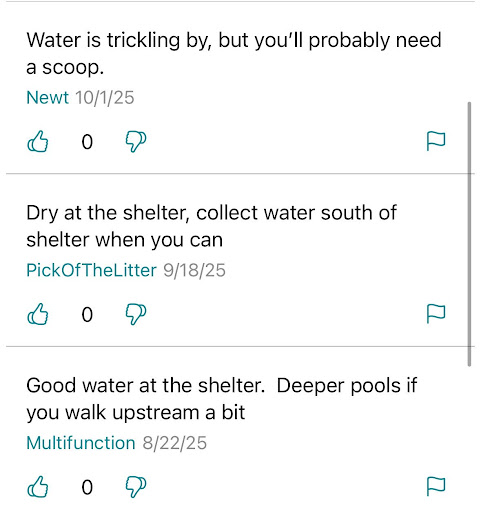
Photo provided by Katie Jackson
Download Offline Map Layers
When you purchase a trail, the default view is pretty bare-bones when you don’t have cell service. Do your future self a favor and download extra map layer views while you’re still in a town! To do this, click the ‘more’ icon at the bottom right and navigate to Settings. Hit the “Manage downloads” button and download whatever you want to access offline; I like having the waypoint photos, Thunderforest Landscape, and USGS Satellite options. Then, back in the Settings tab, click the “Offline Maps” button and set it to your preferred view. Your future self will thank you when you’re in the backcountry and trying to figure out the features of the surrounding area!
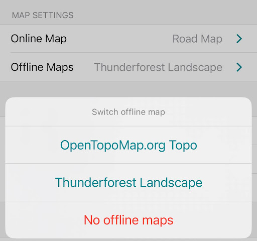
Photo provided by Katie Jackson
Search on the Map
The app’s search function is often faster than manually scrolling. If you know the name of your next destination (a shelter, town, or specific junction), use the search bar to locate it instantly. Find this bar by clicking the three lines on the right of the screen and scrolling to the top of the waypoint list. Once the waypoint is found, you can quickly tap the “View on Map” option to center the screen, confirm your direction, and check the surrounding waypoints.
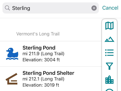
Photo provided by Katie Jackson
Create Your Own Routes
FarOut lets you design your own routes along the paths in the downloaded map. This feature is great for planning, as it lets you see the elevation profile of your route, even if you’re deviating from the main redline. It also lets you quickly visualize your day’s mileage, ascent, and descent.
To create a route, hit the tool icon, followed by “Create a Route”. Long press a waypoint or spot on the trail you’d like to start from, and then wherever you want your day to end. The app will automatically route the shortest path so, if you want to take a different direction at a junction or a detour, go back and long press some points along the path you want to take. When you’re happy with your route, hit the check mark and name your path. Now, when you click the mountain/elevation button, you’ll see the elevation profile for your customized route.
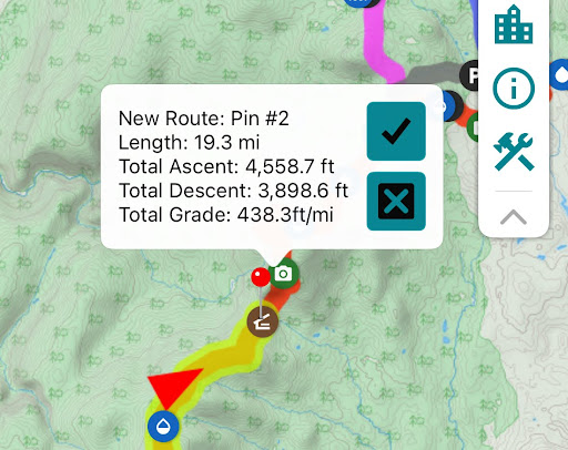
Photo provided by Katie Jackson
“By Trail” vs. “From You”
When looking at a waypoint, FarOut often displays two different distances depending on the circumstances. If you’re on a marked trail, you’ll see “Distance by Trail”, which is the official remaining distance to that point if you follow FarOut’s trail precisely.
If you are off trail (for example, in a town), FarOut will display “Distance from You”. This is the as-the-crow-flies distance. While interesting, do not rely on this for planning, as the trail’s switchbacks and terrain can make the true distance much longer. I’ve made the mistake before, after one too many beers in town, of assuming I’m much closer to a waypoint than I actually am, which has made for some miserable days.
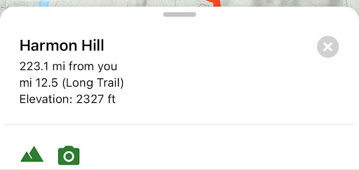
Photo provided by Katie Jackson
By using these features to maximize community data, offline navigation, and custom planning, you effectively upgrade FarOut from a simple map into your indispensable logistics partner. Happy Trails!