223 km / 140 miles • Northern Territory, Australia
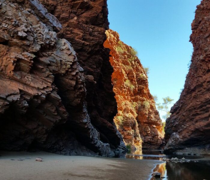
Download our guide to access the Larapinta Trail map, tracks, waypoints, and comments! The Larapinta Trail travels 223 km (140 mi) through the heart of Central Australia. It covers some of the most spectacular ranges and gorges within the vast Australian outback desert. The deep red gorges and cool waterholes offer an oasis in a very hot and arid land. On the rugged rocky ridges, you can see all the way to far off ranges. There is no sign of human development.
US$11.99 / AU$18.99

Buy Once, Works Everywhere

Works Offline

Trusted Trail Data

Detailed Waypoints

Built for Community

Tailored to You


Hike Australia and New Zealand with a saving of 56% over buying the trails separately. This bundle does not include Te Araroa hikes which are part of the Te Araroa Bundle.
Purchase now and get all future trails added to the bundle for free!
This bundle currently includes: Australian Alps Walking Track, Bibbulmun Track, Cape to Cape, George Bass Coastal Walk, Greenstone and Caples Track, Heysen Trail, Kepler Track, Larapinta Trail, Milford Track, Overland Track, Routeburn Track, Three Capes Track, Walk the Yorke, and Wilsons Promontory Grand Circuit.
US$53.99 / AU$79.99
Australia, 231 km, Desert/Outback, 13-18 Days.
The Larapinta Trail, in the heart of Central Australia, runs 223km along the spine of the West MacDonnell Ranges covering some of the most spectacular ranges and gorges within the vast Australian outback desert.
The deep red gorges and cool waterholes offer an oasis for a refreshing swim in a very hot and arid land. On the rugged rocky ridges, formed millions of years ago by the rock layers being pushed on edge, you can see forever – to far off ranges without any sign of human development.
US$11.99 / AU$18.99


