Photo provided by Crystal Gail Welcome
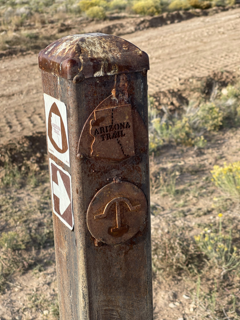
I am section hiking The Great Western Loop (GWL), a 6,875-mile hike through five National Scenic Trails in the Western United States. One of those trails is the Arizona National Scenic Trail (AZT). The AZT is a total of 800 miles, but only 320 miles of those miles are part of the GWL. Despite that, I decided to complete the entire AZT for a finisher’s belt buckle. I completed a calendar year thru-hike (which I learned was a term) for that belt bucket. That’s not a joke. I am highly motivated by medals.
For me, the 2022 hiking season was a testament to perseverance marked by many bright cloudless days, downpours, challenges, and difficulties. Whoever said thru-hiking is easy likely doesn’t understand the definition of easy. I started my trek heading southbound (SOBO) on the Arizona Trail, picking up in Pine, AZ, where I ended my hike in 2021.

Photo provided by Crystal Gail Welcome

Photo provided by Crystal Gail Welcome
Some think Arizona is one big desert. Images of dunes, tumbleweed adrift, and saguaro cacti commonly come to mind. Yet, the AZT offers those features haphazardly while also displaying plateaus, mountains, rocks, snow – yes, snow -, spiky plants, lakes, rivers, wind, cows, wild horses, snakes, and javelins. The latter was my favorite discovery.
The AZT’s diversity in climate, flora, fauna, and creatures change with each mile. As such, navigation was baffling at times. Nevertheless, I maneuvered through the solitude of rolling highlands, comforted by visions of the AZT finishers’ buckle. As a SOBO hiker, I didn’t have the luxury of hiking with a partner and only met folks in passing. Though lonely, I sometimes considered this aspect of my journey the norm. I met many NOBO hikers throughout the day and could hear more hiking by my tent during the night. I connected profoundly with a hiker who recently visited my Minnesota home.

Photo provided by Crystal Gail Welcome

Photo provided by Crystal Gail Welcome
The AZT was not without long water carries, or longer road walks without views. Personally, the AZT doesn’t rank high on my list of favorite trails. Though aspects were amazing, like the Grand Canyon and Miller Peak, it’s not a trail I would readily do again. Generally speaking, I’m not an advocate for completing the same trail more than once. But in full transparency, even if I were, I don’t think I’d ever set foot back on the AZT.
On my final day, helicopters flew overhead as I ascended the 9,465 feet to Miller peak (the second highest point on the AZT). The desert view from the summit was breathtaking. But I felt sadness when I realized the reason for the helicopter. I was crossing the border on April 1, 2022, when I met a young ex-pat hiding from border patrol the day before. My triumph was celebrated by border patrol while she and her family hid in the periphery to evade capture and deportation. I believe that is something for all outdoor lovers to ponder. How can we make the outdoors accessible, fun and safe for everyone, especially when Nature has been a place of harm?
Northern terminus: Utah border at Stateline Campground
Southern terminus: Mexico border at Coronado National Monument
Challenges: Long water carries, long road walks without views
Highlights: The Grand Canyon

Photo provided by Crystal Gail Welcome


Photos provided by Crystal Gail Welcome
From the AZT, I took a train to the Pacific Crest Trail (PCT). I love traveling via Amtrak. Perhaps because I was a smelly hiker, was a handful of stops away from my destination, or maybe the conductor was in a giving mood – either way, I was upgraded to a sleeper car—a highlight of my journey for sure.
I hoped to start the PCT where I finished last season in Kennedy Meadows South, and head northbound (NOBO). However, it was April, and there was a lot of snow and no other hikers. Against my principles, for mental health and safety reasons, I backtracked, redoing sections of the PCT that I’d already completed, and joined the PCT Class of 2022 in Big Bear, CA.

Photo provided by Crystal Gail Welcome

Photo provided by Crystal Gail Welcome
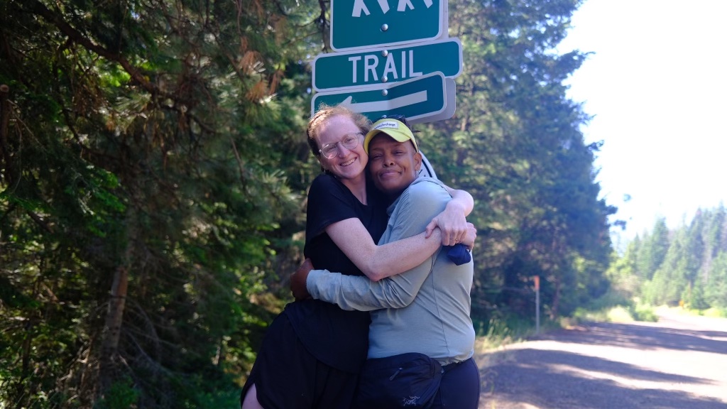
As far as FarOut goes, it was humorous being one of the last people to post the previous season, reading the comments I left for would-be 2021 SOBO hikers as a current NOBO hiker in 2022. A large portion of the PCT closed the previous year due to wildfires. Nevertheless, my time on the PCT 2022 was filled with wonderful memories. Martha, the lead staff at Hiker Town, nursed me back to health following a bout with norovirus. Kim and Harry camped beside me for two nights, sharing dinner and stories with me. Anne, the park service worker who fixed the hole in my sleeping bag, transported me around a previously hiked section weeks later. I did some yo-yoing to make a book reading. Some of the folks I met in town restored my faith in humanity. Others, like the two that called the cops on me, were reminders of what’s wrong with our planet.


Photo provided by Crystal Gail Welcome

Photo provided by Crystal Gail Welcome
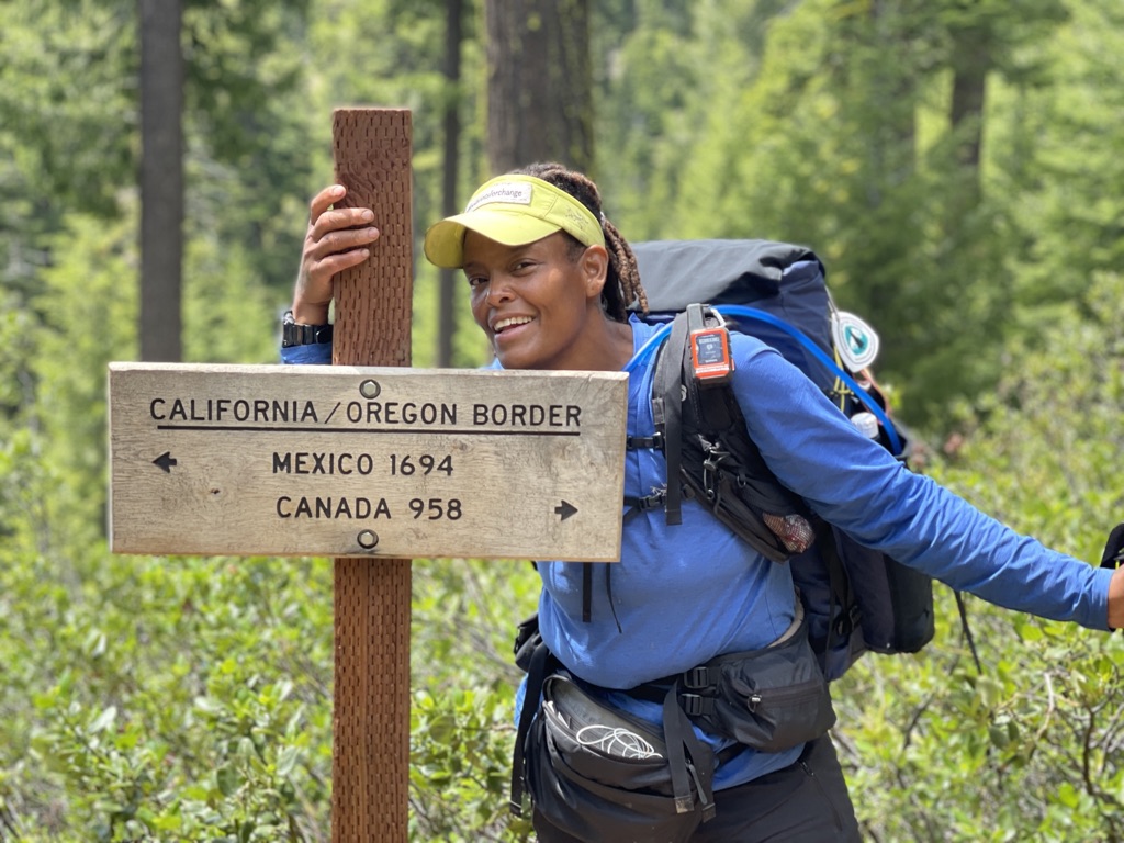
I hiked 160 days, five long months, crossing the California-Oregon border. I made my way to Elk Lodge near Bend, Oregon. I’d been in pain for nearly 100 miles at that point and could no longer withstand hiking. In what was first believed to be a freak splinter accident, I was scheduled for surgery. Two lovely trail angels, Liz and Tom, housed me for over a week while I waited for surgery. Surgery revealed osteophytes due to long-term repetitive impact. My body needed rest, and as I write this, I continue to rest. At 2,384 miles, 2022 has been my longest hiking season to date. While I am sketching plans for the 2023 season, one thing I know for certain is I’m not hiking a trail without a map and compass in addition to the FarOut app. Without either, I’d likely be living out in the Arizona wilderness amongst the wild horses, cows and javelinas.

Photo provided by Crystal Gail Welcome


Photos provided by Crystal Gail Welcome
Related Trail Guide

The FarOut app is the official hiking guide for the Arizona Trail. The Arizona National Scenic Trail stretches 800 scenic miles (1280 km) across the state of Arizona from Mexico to Utah. It passes through some of the most diverse and beautiful landscapes in the state, including multiple National Forests, Saguaro National Park, and Grand Canyon National Park. Check out our interactive AZT map today!